October 17, 2001

Bird and Migration

THEME: Birds
SUBJECT AREA: Geography
TOPIC: Migration

2001 October 17, Wednesday

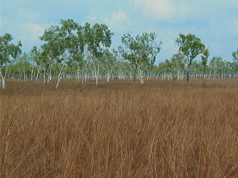
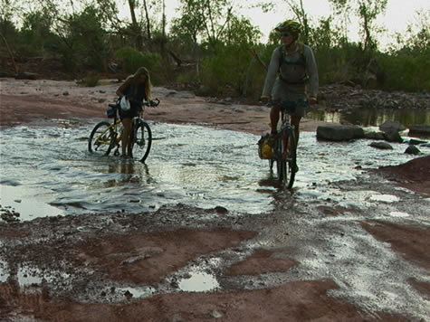
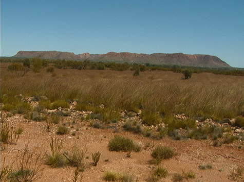
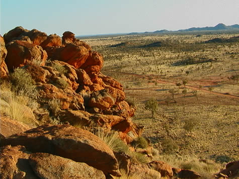
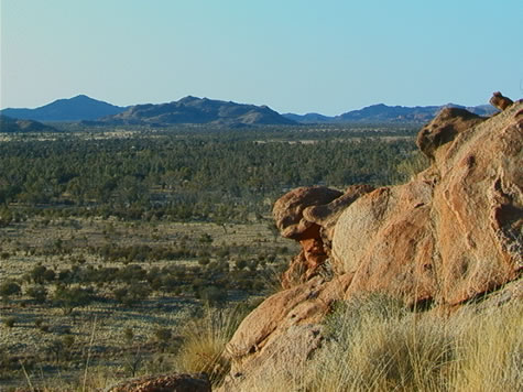
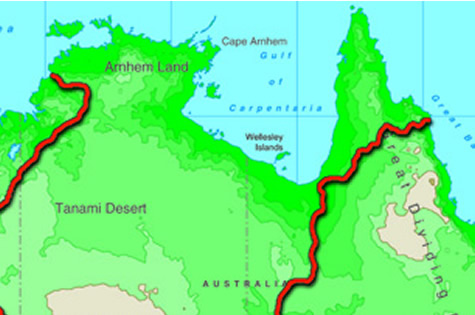
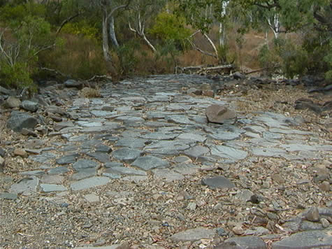
If you have been keeping up with us this far you probably know a little about the Wet and the Dry. --Seasons, that is. The Wet is when the Top End of Australia receives almost all of its rainfall (around 64 inches between November and April). The Dry is just the opposite—almost no rain to speak of between May and October. This sequence was a big determining factor for our itinerary since, during the Wet, so many of the dry river beds that we’ve passed through are surging with water and impassable.

This weather duality affects the itinerary of birds here in the Top End as well. It’s now mid-October and the usually strong south-easterly wind of the Dry season is beginning to abate. Many migrants take advantage of these seasonal wind shifts as they travel from south-east Asia to the top of Australia.

black_necked_stork.jpg

Many other transformations are beginning to take place to make the place appealing for these tourist birds as well. The Wet season is when large flying insects are at their peak. This is hard to resist for the dollarbirds. Native fruits become more common, too, which has the common koel and the channel-billed cuckoo just salivating all the way from New Guinea and Indonesia. When it’s back to the Dry season again, some of these birds will be packing up and heading north for better dining.

Shorebirds will also be at their most common as the top of Australia gets soaked again. Wading birds like the curlew, knots, sandpipers and plovers are forced to go south from as far away as Siberia because it’s just getting too cold for them up there. When they land in Darwin or Kakadu National Park, they may have been flying for up to 72 hours and hit the ground eating when they land (just like Crister does when he stops biking).

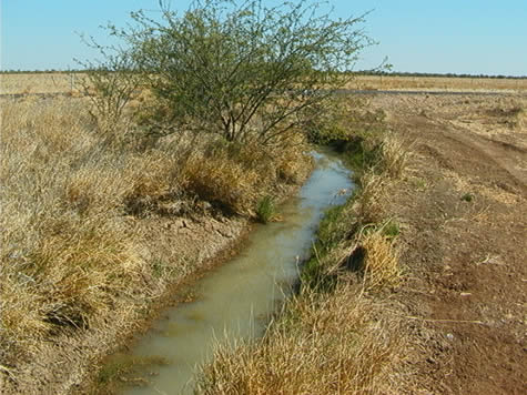
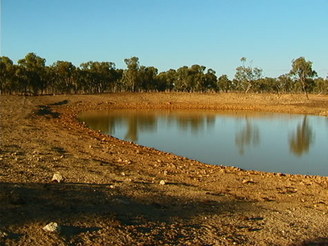
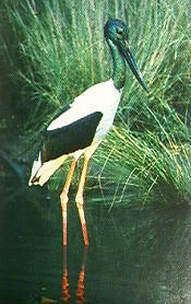
We’re at the end of the Dry now, a time when this area sees a lot of activity from the native Australian birds as well as the out-of-towners. It’s the time when the swamps and billabongs have receded to their utmost. Thousands of native water birds are starting to arrive to enjoy the easy pickings underneath—platters of crustaceans, amphibians and fish or, for the vegetarians, wild rice and rushes as they prefer. These birds include whistling ducks, magpie geese, the Jabiru stork and the pied heron.

Darwin is only a stopover point for some of these birds, a place for a little rest. Some plan to fly all the way to the bottom of Australia to make their home until the Dry moves in and it’s time to turn around and go north again.

Suggested learning activities: Find out what types of birds make their way past your house over the course of the year. Why might you see them there when they do?

todd

October 16, 2001

Pine Creek Region - The Wet Season

THEME: Pine Creek Region
SUBJECT AREA: Geography
TOPIC: The Wet Season

The weather in Australia is almost in reverse to the weather in the Northern Hemisphere. When it is winter down here in Australia it would be summer in Europe. In North Australia there is a saying that during the summer it is the “wet season” and the winter is the “dry season”. The two seasons rarely have anything in between - such as autumn and spring; these seasons are predominantly found in more northern latitudes. As you get closer to the equator there are fewer seasons, mainly just one season through the year. Temperatures and climate remain much more constant with little variation in either.

white_gums_in_floodway.jpg

Comparing rainfall from the more arid Alice Springs to the tropical Darwin you will notice a major difference. From November, December, January, February and March (the wet), average rainfall is around 1290 mm in Darwin, compared to Alice Springs at 190mm. The dry season in Darwin has an average of 22mm, compared to Alice Springs at 39mm. The Monsoon Trough that passes through the tropical climates during the summer months, bringing consistent rain, storms and occasionally cyclones, can explain the dramatic difference in the two towns.

In Australia there is a competition called the Golden Gumboot (wellington boot), a competition of the town that records the most rainfall. Two towns in North Queensland always fight over who gets the most rainfall. These two towns - Mirriwinni and Tarzali - are on opposite sides of a mountain range. It would not be uncommon for either town to record up to 3000mm of rain in one year.

Suggested activities: Examine annual rainfall amounts in your area. Which season has the heaviest rainfall amounts? Explain how the local geography plays a role in affecting yearly rainfall. Why do locations on one side of a mountain range get more or less rain?

Feed your children wheat. Joshua.

October 8, 2001

Limestone Gorge - Stromatolites

THEME: Limestone Gorge
SUBJECT AREA: Geography
TOPIC: Stromatolites

On our past weekend, we got to have two full layover days, or rest days at Limestone Gorge. Its rock walls, swimming hole, and beautiful hikes were taken in fully by myself, and the rest of the group.

On the hikes you could learn about everything the park had to offer from flora and fauna, to the unique rock formations and structures surrounding you. A really neat thing I learned about were the fossils called stromatolites. They are considered to be the oldest known evidence of life on earth!

stromatolite.jpg

They are formed in shallow seas or lagoons when millions of cyanobacteria (primitive bacterial life forms) colonise together in a cabbage shaped growth. Filaments, poking out from the bacteria trap sediment and eventually become fossilized, thus creating stromolites.

At Limestone Gorge there are a lot of stromatolites at the Skull Creek formation. They are way cool to see and understand what you are really looking at!

They can be found under the earth about 20 metres and are sometimes exposed by the elements like here at Limestone Gorge, so we can see them!

Suggested learning activities: Investigate unusual rock formations and types of rocks in your area. How were they formed and from what type of geographical feature? Was your area once an ocean or a shallow sea? What fossil evidence might indicate this?

Crister

October 2, 2001

Gregory National Park region

THEME: Gregory National Park
SUBJECT AREA: Geography
TOPIC: geography of the Gregory National Park region

2001 October 2, Tuesday. Gregory National Park, Bullita Sector.

Gregory is a relatively new national park, officially listed in 1990, and incorporates two separate parks, separated by Stokes Range (Aboriginal Land). Including land excised from neighbouring cattle stations, and encompassing nearly one million hectares, it is the Northern Territory’s second largest National Park, after Kakadu.

Less than one hundred kilometres to the northeast lies Joseph Bonaparte Gulf. Here, the Victoria River drains into Queens Channel, an inlet of the Timor Sea, and the gateway to the Indian Ocean. Although the tributaries to the Victoria are all fresh water reservoirs, estuarine or saltwater crocodiles are found throughout the waterways of the park.

There are approximately eight hundred national parks in Australia. Rangers patrol the more popular parks to make sure no-one abuses protected areas, and to answer questions and act as guides.

greg_park_boab_marker.jpg

The Northern Territory has more than one hundred listed national parks and reserves covering 4.4 million hectares (10.8 million acres), and 229 000 hectares (565 900 acres) of marine parks. They are administered by the Parks and Wildlife Commission of the NT, except for Kakadu and Uluru-Kata Tjuta, which are World Heritage Listed.

Some of the Northern Territory’s national parks are so isolated and rugged that they attract few visitors, and most only to look. Others are popular recreational areas, and are among Australia’s major attractions. Public Access is encouraged if safety and conservation regulations are observed. See today’s e.s.d. update.

Suggested learning activities:
Discover a national park near your home. Try to answer some of the following:
* How much land does it cover?
* What is unique about its ecosystem?
* What endangered native animals does it protect
* What land systems does it encompass?
* Is it a popular tourist place?
* When was it declared a national park?
* Why was it declared a national park?
Find the national park on a map.

bel

October 1, 2001

Victoria River Basin

THEME: Victoria River District
SUBJECT AREAS: Geography
TOPIC: Geography of Victoria River Basin

The land changed quickly on the way north from Lajamanu today. It was quite noticeable that we’d left the Tanami Desert behind as the spinifex-dotted expanses gave way to escarpment country, covered with Mitchell and kangaroo grass.

joshua_gum_escarpment.jpg

We are presently in the western half of the Barkly Region of the Northern Territory. It is the transition zone from the green of the Top End to the red ochre of the centre. The rich Victoria River pastoral district we have entered is predominately cattle country and well suited for it. Imagine our amazement as we crossed Gordy Creek and there was actually water in it! So many of our campsites have been dry over the course of the last several weeks. When we crossed the Victoria River (full of water, I might add!) on our way into Kalkaringi, it was almost sensory overload as water has been so scarce.

As might be expected in this geographic transition zone between the tropical Top End and the arid centre, the rainfall in this region varies markedly, from around 400 mm in the south to well over 1000mm along the coast. Rainfall in the Victoria River district falls somewhere in between, with this spring being an exceptionally wet one (see the photos of the police station; one taken in March this year, the other taken today from the same camera angle). The local citizens in Kalkaringi speak of large thunderstorms developing in the late afternoon and releasing torrents of water. The country we’ve been riding through is a testament to that fact the grass and other vegetation are significantly greener this time of year compared to years past.

crister_april_xing.jpg

Sandstone gorges, high cliffs and flat-top ranges await us in the next few days as we travel toward Gregory National Park. We have definitely entered a new geographic region! And, this evening as we crossed the Victoria River leaving Kalkaringi, we discovered a made-to-order water slide! We bailed off the bikes into the cool rushing water as it tumbled over large rock surfaces in the roadbed.

Suggested activities: Compare rainfall amounts and vegetation in your region. What types of plants are best suited to your climate? Does your region’s geography have an impact on the local economy agriculturally speaking, and, if so, how is it impacted? Study the effects of drought in your area. Investigate what is done to compensate for dry seasons.

April

September 27, 2001

Geography and Land Ownership Rights

Aboriginal Rights and GEOGRAPHY

Land Rights:

Since Alice Springs we’ve been biking through predominantly aboriginal freehold land. This means the land was given back to the traditional aboriginal owners sometime since The Aboriginal Land Rights (NT) Act of 1976, which for the first time in Australia’s history recognised the relationship between aborigines and the land. The brown areas you see on the map, for example, represent such ownership of land – which lasts ‘forever’ and includes all mineral and oil rights under the first 150mm of soil. The white area marks a pastoral lease from the government to the Supplejack Downs cattle station – which means the station owners do not strictly ‘own’ the land, only lease it from the government on a 99 years renewable basis. The other catch is they have no rights to anything of value under the first 150mm of soil.

derwent_station_bel.jpg

So, how does geography play a part in all this? The brown and white areas we see on a map of the North Territory tells us a lot about the surface ‘value’ of the land in terms of water and the capacity to support livestock (predominantly cattle in this case), and the hidden ‘value’ of the land in the form of mineral and oil deposits. They also give us some clues as to the whereabouts of landforms and geographical features in the landscape that are considered sacred by local aboriginal ‘guardians’. The reasons for both are as follows:

When the Aboriginal Land Rights (NT) Act was passed in 1976, the only land allowed to be claimed was land outside town boundaries and that not already owned or leased by anybody else. This, for the most part, meant either semi-desert or desert as any ‘valuable’ land with water on it (in the form of springs or bores) or vegetation that could support cattle on it, would already be spoken for. So, you could say that only land that was useless to the settlers would be given back, as a form of tokenism to defuse the rising pressure the government was facing from aboriginal groups seeking Land Reform from WW2 on. The brown areas therefore largely represent desert regions of little economic use, whereas the white areas represent pastoral leases on land that has water or is in some other way of economic value to the people farming it.

tanami_desert_map.jpg

Sacred sites are also key to the whole Land Rights Issue, as one of the conditions for land to be given back to its traditional aboriginal owners under the Aboriginal Land Rights (NT) Act is that a claimant has to prove under aboriginal law that they are responsible for the sacred sites on the land being claimed. Such sacred sites represent evidence of a dreamtime ancestor having passed that way and left some mark: a pile of stones or even a tree. Some sites are very obvious – like Uluru (Ayers Rock). Others are less so and might not even be visible to the human eye. So the geography of the landscape is very often instrumental for determining whether a piece of land is returned to its traditional aboriginal owner or not.

We can conclude therefore that by looking at a Land Ownership map of North Territory we can make some rough guesses as why certain areas are coloured the way they are and what assets – either economic or religious – the land holds.

Suggested Learning activities: research an example of land ownership conflict in your local area and make some calculated guesses as to what ‘value’ the land represents to the interested parties and for what reasons they might therefore be in conflict with each other.

September 24, 2001

Extreme Climates - The Tanami Desert

Geography – Tanami desert

The beginning of the Tertiary period in the earth’s history was typified in central Australia by high temperature, rainfall and silcrete formation in extensive low-lying inland areas such as the Tanami Desert. This resulted in the deposition of the poor, sandy soils that we’ve been biking through the past 3-4 days since arriving at the Tanami track.

tanami1.jpg

So why is the Tanami Desert flat but not so the Macdonell Ranges to the South and The Kimberly to the Northwest? One theory is that the Tanami forms a pivot around which a gigantic block of the earth’s crust rotated forming mountains (Macdonell Ranges) and a trough (The Kimberly). The central Tanami area – being the pivot – has therefore avoided any influence from uplifting or tearing of the earth’s crust.

This flat terrain promotes a semi-arid climate, as any moisture from rainfall perculates quickly through the upper strata of sandy soil. Also, any influence from the ocean in the form of moist air, for example, is minimal. However, fluctuations in global weather patterns can affect the geography and ecology of the region quite considerably, making it possible for a non-indigenous species – like the rabbit – to thrive so well as it has in the past (hence the name Rabbit Flat where we spent most of today laying up from the midday heat). For example, for the past 3 x years Australia has been experiencing unsually wet conditions, with higher than average rainfall. This has led to there being far more vegetation that we expected. Instead of miles and miles of bare sand dunes we’ve been treated to quite a varied desert-scape rich in spinifex, desert oaks, acacias and mulga trees.

Suggested learning activities: examine a region in your country that is subject to quite extreme climatic conditions. Investigate how fluctuations in weather conditions have affected the region’s geography and/or ecology.

September 16, 2001

The Geography of Gosse's Bluff

Geography – day 55

While biking on the road from Hermannsburg we explored an incredible feature in the landscape: Gosse Bluff; a 5km wide crater thought to have been formed by the impact of comet slamming into the earth’s surface around 140 million years ago.

gosse_bluff_crater.jpg

The shallow depth of the blast lends weight to the theory of either a comet, or a low-density asteroid and not a solid rock meteorite. However, no trace of a comet or asteroid was been found in the area, and it is presumed to have vapourised.

The blast has been calculated to have been about one million times more powerful than the Hiroshima bomb. It would have destroyed most life forms within a distance of hundreds of kilometres and sent huge plumes of fine debris into the atmosphere, affecting weather patterns worldwide for some years. This would certainly have made for a very challenging environment for plant and animals species seeking to recolonise the surrounding area after the event.

During the blast, fragments of rock, included blocks up to a hundred metres long, were hurled into the air and then fell back to the ground.

The comet would have consisted of a frozen ball of carbon dioxide, ice and dust. Late Proterozoic-Cambrian Rock, 500-800 years old and comprising sandstone, siltstone, shale and limestone, would have been blasted to the surface from more than 6km down. Using satellite imagery we can estimate the original outer crater being up to 20km in diameter. A long period of erosion and wet climate has have since removed this almost entirely, leaving the inner crater of 5km that we see today (see photo).

There is a close parallel with craters that can be found on the surface of the moon and Mars. Similarities are the breaking up and bending of rock layers with in a roughly circular area, a crater, uplifted rock in the centre, shatter cones, melted rock fragments, and minerals that are formed only at extreme pressures.

Suggested learning activities: look at how volcanoes are formed and explore the differences and/or similarities to the impact of extra-terrestrial bodies into the earth’s surface (like at Gosse Bluff).

September 4, 2001

Landforms - Corroboree Rock

Just off the Ross Highway, some kilometres northeast of the Emily and Jessie Gaps, is a weathered, rippled rock called Corroboree. It began to be formed some 800 million years ago when a shallow, salty sea laid down a fine silt. Algae grew over this silt and shaped itself into mounds that solidified into rock over millions of years.

corroboree_rock_back2.jpg

The movement of the earth caused the folding of strata (layers) of rock into the vertical plane, causing the original horizontal layers to stick straight up out of the earth in the form of a ridge. Wind, rain and sun gradually wore down the ridge, with only Corroboree, a particularly hard section of rock, remaining today.

The three predominant colours in the rock are black, orange, and white. The black colour comes from the oxidation of iron particles within the stone, and the orange and yellow are the result of tropical weather conditions.

Suggested learning activities: Identify an example of weathering of a geological feature in your local area. Compare and contrast the weathering forces (sun/rain/wind etc) to those operating on Corroboree.

Git

September 3, 2001

Geology & Heat Conduction

2001 September 3, Monday. Bluff Camp Ground.

As we rode between Ross River Homestead and Trephina Gorge Nature Park yesterday evening, the moonlight showed clearly the silhouettes of craggy rock peaks, though the road snaked gently through the broad valley bottoms. We became aware of significant changes in air temperature as we turned corners and passed by different vegetation, and traced this variation to a number of sources:

Throughout the day, warmth from the sun is absorbed by the earth. Rocks, sand, and hillsides, all are hot to the touch by mid afternoon in the powerful desert sun. As night falls, the sun no longer warms the air, and gradually the entire landscape freshens.

red_rock_outcrop.jpg

First the eastern aspects of the hills, which have already been in shadow for some hours, begin to chill. Creek beds follow closely after, because of the moisture from underground sources, and the protection offered by the vegetation including river red gum trees. West facing slopes and dry exposed earth reach a higher temperature throughout the day, and take longer to cool after sunset.

The various times taken for these features to release their solar heat create these pockets of different temperature air, and the still of these winter evenings combined with the protection offered by the mountains prevents the temperatures between them from equalising quickly.

Because of this system, the earth has lost all of its stored heat by dawn, and the burning heat of each day begins with a cool morning – sometimes approaching freezing point. This is the time we do our most efficient biking, and the main reason we tried a night ride.

Go for a walk out of doors and feel the temperature of different objects, both in and out of direct sunlight. Try grassy and open ground, a tree trunk, a concrete surface and a piece of metal. Which objects conduct more heat? Write down your observations.

bel

August 29, 2001

The Huckitta Land System

Wednesday 2001 August 29. North of Claraville Homestead.

Having passed the ‘Huckitta’ Station turn off earlier in the day, it was interesting to learn that the foothills we are now entering is called a Huckitta Land System.

“The Huckitta Land System of rugged limestone ranges in the central part of Australia covers about 1600 square kilometres. Its steeply dipping and often contorted limestone hills reach a height of up to 225 metres.”

rocky_huckitta_outcrop.jpg

Climbing a few of these rocky hillocks yesterday evening gave a terrific demonstration of how the aspect (direction a slope faces in relation to the sun) even of small dry hillocks, impacts the vegetation which will grow there. The sunny side of a hill (in Australia this is the north) is hotter and drier than the slope which is shaded during midday heat. This is true for mountains thousands of metres high, right down to large boulders on relatively flat land. Liverwort will assert itself on the hospitable side of a rock only, and it is possible to find direction by observing this.

The shaded side of a slope causes a number of environmental conditions to vary. Some of the most noticeable include the amount of precipitation received, the change in humidity levels, the temperature difference, and the amount of solar energy available. Different plants thrive under these different conditions.

Over many years, larger amounts of water and sunlight have an effect on soil composition, by encouraging organic matter to grow and break down in the earth, enriching it, and increasing the variety of plants able to grow in those areas.

Think about how your household’s food scraps (organic waste) is disposed of. If you have a garden, suggest to your parents that you begin composting. If you have a compost heap already, find out how it works, and who maintains it. Adding compost to your garden will allow you to grow plants including vegetables which otherwise would not thrive in the same space.

bel.

August 28, 2001

Geology & The MacDonnell Range

The MacDonnell Range we entered today is a freak of Australian geography in so much that it is the only mountain range in Australia that runs east west. All the other ranges run north south.

rocky_huckitta_view.jpg

Approximately 850 million years ago a shallow sea covered the whole area. Then approximately 600 million years ago the range was formed from the flat land sliding vertically during land movement.

During heavy rainfalls, water carves the rock causing widespread erosion over the mountains, leaving amazing rock formations through the range. If the rock hadn’t been washed away over the years the MacDonnell range would be about as big as the Rocky Mountain range in Canada.

Feed your children wheat. Joshua.

August 23, 2001

Northern Territory

The sign said ‘Welcome to the Northern Territory of Australia: Nature Territory’ as Mike and I passed, leaving behind Queensland and crossing into the Northern Territory. A contrast between what we’ve left behind and what we have to look forward to seems in order.

bel_terr_border_sign.jpg

The area of Queensland at 1,727,200 square kilometers, makes up 22% of the Australian continent. Green, productive lush rain forests, fields of sugar cane, and national parks on the east between the Great Dividing Range and the Coral Sea, give the tourist industry an outlet to the Great Barrier Reef. To the west of the Great Dividing Range, vast areas of agricultural land rich in volcanic soils comprise the tablelands.

Perhaps the region that we’ve spent the most time cycling through is the vast outback that lies inland. It fades into the Northern Territory to the west. Rain can make this arid region bloom, but it’s a land of sparse population, long empty roads and tiny distant settlements.

We’ve seen examples of the collection and storage of water from the Great Artesian Basin, created over a period of 2.5 million years as water gradually seeps westward from the Great Dividing Range. It fills approximately 7500 artesian wells that provide the only source of continual water for huge cattle stations. The Wet season does provide a variation on this theme as countless dry river beds become swollen creating a network of waterways which can make travel impossible.

biking_with_windmill.jpg

By contrast, the Northern Territory makes up 17% of the Australian landmass, an area of 1.35 million square miles. Although about 80% of the Territory is in the tropics, as the Tropic of Capricorn bisects the continent north of Alice Springs, only the northern 25%, known as the Top End, resembles a tropical climate. There, savannah woodlands and occasional rainforests are in direct contrast to the desert, semi-arid plain in the southern three-quarters to the south.

Today we have slipped through the door to the Northern Territory. Alice Springs, to the southwest, awaits us as we journey toward the Red Centre.

Suggested activities: Compare regions where you live, i.e., climate, temperature averages, rainfall, topography. Investigate the reasons why these regions vary in contrast to each other. Identify mountain ranges and plateaus, which influence rainfall amounts. Discuss how is agriculture affected by climate and what types of crops/livestock are grown near you.

August 22, 2001

The Artesian Basin - Origins of Water

Geography
22 August 2001

The Great Artesian Basin has had an effect on both the way humans and many animals live in the Outback. For humans it has been a reliable source of water in an area where nothing but hot summers are guaranteed. Sure, reservoirs are built out here to hold the huge amounts of water that fall during the wet season, but what happens when there’s a drought? The water that is stored in the reservoirs can also evaporate well before the summer rains begin again. The Basin is a huge pool of water below ground that can be tapped by wells and accessed anytime of the year. With this almost guaranteed supply, the risk of not having enough water to raise cattle in this area is reduced significantly. Stockmen in this area of the country are able to raise many more animals and are primarily limited only by the amount of food available from the land. The Basin is also the main water source for many of the towns that exist in this part of the Outback.

open_chan_irrigation2.jpg

The troughs of water that the stockmen provide for their cattle help other animals as well. Kangaroos can maintain larger families because of the availability. Flocks of budgerigars (budgies) and other birds can find more places of refuge than they could before people began tapping the water below and bringing it up to storage areas above.

In other arid and semi-arid parts of Australia, away from the Great Artesian Basin, water is often the most limiting factor for the existence of any life, whether human, animal or plant.

Suggested Learning Activity:
Find out where your water comes from.

August 16, 2001

Geography of Burke and Wills Expedition

australia_map_cut.jpg

The coast of the Gulf of Carpentaria includes some of Australia’s wildest and most remote country. Before early explorers returned from the area with tales of unparalleled hardships, a plan existed for the coast to harbour a busy port, trading with the wealth of Asia. However, the terrain made any such plan an impossibility.
The Gulf coast is interlaced with hundreds of drainage channels carrying wet season rains away from the flat country farther inland. The flatness of this inland terrain causes the water to sweep across the plains in sheets, or thousands of tiny rivulets, rather than being directed into one or two major rivers. In mountainous country, rivers run only into each other. Here, the land is so flat that water can and does flow out into two or more forks from the one source. This constant fanning out of watercourses, combined with a sheltered coastline and a tropical climate, results in a twisting, jungle lined delta – utterly inaccessible by an overland route to this day.

Burke and Wills discovered at first hand just how challenging (and at times just downright impassable!) the gulf country could be, most notably in the wet season. They were even prevented from completing the last 6 kms to the ocean because of their path being blocked by mangroves. Imagine how frustrating this must have been having just walked 1100 kms! They took the tidal flow in a nearby river as proof of completing their mission – to reach the sea – before turning around and heading back again..

The following is an excerpt from Alan Moorehead’s ‘Coopers Creek’.

“They had struck the wet season; day after day the warm rain poured down, and the camels hated it. They foundered around in the boggy ground, moaning and groaning, and Billy the horse grew very weak. Something like 170 miles still divided them from the sea, and they followed the Cloncurry River downstream to the point where it joined the Flinders River….by the end of January they had reached the Flinders River, and were moving slowly down the Byrno, which was one of its outlets to the sea. The mud was frightful.”

Suggested learning activities:
- research other examples of flood plains either in Australia or another country. Make a comparison between how rivers behave in a flood plain versus a mountainous terrain. Draw pictures where appropriate.

August 14, 2001

Landscapes

2001 August 14, Tuesday. 45 kilometers North of Julia Creek.

The Great Dividing Range borders the east coast of Australia and shelters the infinite plains which stretch virtually unbroken to the west coast. From the vast Nullabor across the Great Australian Bight in the south, through the Great Sandy desert in the Red Centre, to the Gulf Savannah Grasslands where we have made camp this evening, the land is extraordinarily, uniformly, flat.

jim_biking_long.jpg

Today, the insignificant undulations we had cycled across, and which provide drainage for rainwater, petered away gradually, and fell into a floodplain. The trivial alteration in ground level was not enough to discern with the naked eye, and the land is parched at this time of year. However, it could be seen from the vegetation, and the signs of cattle hooves having sunk into the earth at some stage, that tremendous amounts of water once drained into the area. The utter absence of trees of any significant height within eyeshot, suggest that it also spent a lot of time draining into the clay subsoil to join underground reservoirs.

Throughout the trip we have crossed a great many rivers and flood ways – dry and otherwise – but none so interminable as today’s, which stretched for over thirty kilometres, leaving us yearning for shade. The view was unimaginable – reaching endlessly to a mirage scattered horizon.

How far into the distance are you able to see from your bedroom window? How far can you see from your yard? What eventually blocks your view – hills, trees, or buildings?

bel

August 12, 2001

Maps

2001 August 12, Sunday. Between the Gulf Developmental Road and Flinders Highway, NW of Malpas Station.

Cycling in the Far North of Australia can potentially be a dangerous undertaking, but even when driving out here, you need to be aware of hazards. Our support truck has its own adventures negotiating the backroads to meets us with supplies. The land is largely untamed and water supply is sparse. Wildlife can be a danger if you do not know how to handle a surprise encounter.

Tourist Maps of the areas we are passing through have many warnings on them for the benefit of travellers who are unfamiliar with the countryside:
“NOTE: Entry to some Aboriginal Communities is restricted and may require approval in writing from the community council.”
“WARNING: Swimming in tropical waters in summer can be dangerous due to marine stingers. Always seek local advice.”
“DANGER: Track conditions are subject to frequent change. Creek crossings are generally unimproved and often difficult to negotiate.”

crister_joshua_gps.jpg

Other interesting things marked on our maps include Ghost Towns, vast salt pans and marsh land, sand ridges, swamps, caves, ruins, and hundreds of kilometre long roads marked simply ‘surface unspecified’. Relentless erosion owing to the torrential rainy season, can change the condition of unsealed roads at an alarming rate.
Much of the land is changeable, and even with recent maps, it is best to ask locals for advice on the areas you are about to enter. Dry and temporarily dry rivers and lakes are common, and it is difficult to know whether you will face an impossible deluge, a dry, sandy depression, or a lovely clear swimming hole. What can appear to be a town on a map might turn out to be only a small homestead.

What types of things could you mark on a map of the area where you live, which might be unusual to people from different parts of your country, or from around the world? What similarities might there be? Does the land change around the year? Do the roads change? What warnings can you think of which you could tell a tourist who was driving to your house? What could you tell someone who was going to ride their bicycle to your house?

bel

August 9, 2001

Communications & Settlement

Today we followed communication lines that have served the needs of the people living out here in the remote outback for the past 150 years.

natural_pavement.jpg

- In the beginning there would have the old coach-road built and used by Cobb and Co. This was partly visible today snaking back and forth beside the new sealed one. The stagecoaches would have brought in mail and essential supplies to the communities along its route.
- At the turn of the century a railway was built (just to the south) to transport ore, cattle and passengers to and from markets.
- The telegraph line beside the road would have provided people with communications with the outside world. One major benefit was the ability to communicate with medical services in an emergency.
- The modern sealed road we rode on today brings tourism dollars to the area and a way for the dreaded road-trains to get from A to B.

communications_tower.jpg

Suggested learning activities: Find out about a major road in your area and research its history. Was it always a road? How would it did it affect your community once built. Were the effects positive or negative? Explain your answer.

Jason

August 7, 2001

Open Earth Tanks

There are two important questions that need to be asked in the construction of open earth tanks. Why not dams, and how do you decide where to build an open earth tank?

dam_dirt_and_treeline.jpg

Tanks are not dams. Dams are a construction where by you blocks an existing waterway and tanks are an excavation into which water is diverted. Because tanks only collect a small amount of the water that goes through the waterway, controlling the excess is a vital factor. This is done by the way of constructing earth banks to divert the water initially and then constructing a “bywash bank” which ends on higher ground to allow the tank to fill and the excess water to return to the natural water-way. Unlike a dam that can effect the ecology above it’s trapping point as well as the flow below, the open earth tank does neither of these things and is only used for one purpose. That purpose is to maintain the livestock’s need for water during the dry season.

Due to the huge flow of water during the “wet” dams could not control the water that flows down to the plains nor is there a need for the farmers to try. Tanks remain the most effective way for farmers to water their live stock with out being to intrusive to the natural environment around them.

The second question is how you decide just where to build an open earth tank. The first requirement is to select a strategic area on the station, which is deficient in water for the stock to be able to make use of the natural vegetation. The next requirement is to find a waterway that is sufficient to fill your tank. Sometimes these waterways can be surprisingly small. Next an open flat area is required to accommodate the excavation which can use up to a two acres. Then the trick is to construct the tank in a spot that it will fill easily and the water is not to hard to control.

The open earth tank provides livestock with life maintaining water through the “dry” season in an environmentally non-intrusive way.

John

August 5, 2001

Exploring the Chillagoe Limestone Caves

2001 August 5, Sunday. Pinnacle Springs Station.

The old rail line snakes through the bush seeking a flat route, dodging between high granite rock piles, which balance incongruously above the landscape, and avoiding the networks of tributaries to the Tate River. Their beds are so dry and sandy it’s hard to believe they were streaming rills just four months ago, and will be later this year, as the wet season approaches again.

limestone_outcrop.jpg

Further north the way from which we have come, the granite gives way to limestone and instead of large rounded boulders in piles, jagged limestone monoliths jut from the flat landscape. Peaks as sharp as razors adorn the peaks of outcrops hiding labyrinthine caverns.

The area surrounding Chillagoe is protected by a National Park, which contains hundreds of caves. Limestone is soft, and water penetrates it easily, quickly causing erosion, and leaving the incredible system of tunnels which lie there today.
I took advantage of our rest day in Chillagoe to explore the Royal Arch Caves section of the National Park, using a candle to journey deep into the barren darkness. Nothing can grow inside the caves, because it is so dark. Aboriginal rock art can be found on the peaks above them.

Far down under the earth, moisture seeps from the walls of the caverns, carrying minerals from the sandstone into the air of the cave, where it hardens again. When drips fall from the ceilings of the caves in the same place for a long time, they leave sticks of hardened minerals behind, called stalactites and stalagmites. The two kinds “grow” toward each other from the roof and the floor of the cavern, until they meet and join, and a strong pillar forms which appears to be supporting the cave. These formations can become, over thousands of years, very beautiful and elaborate.

See if you can find out what kind of rock lies under the ground where you live. Have you ever been in a cave? Ask your parents and teacher if they have visited caves. What did they see in there? Bats often live deep inside dark caves, and come out only at night. What else can you think of that might like to live in a cave? Would you like to live inside a cave? Why or why not?

bel

August 2, 2001

Wrotham Park cattle station

Wrotham Park cattle station – Sam’s home – is 1.3 million acres in size. That the same size as Belgium!

Being east of the Great Dividing Mountain Range the ground is gently undulating with creeks (rivers) criss crossing the landscape. In winter (May-October) most of these will dry out completely. Dams are built in the dry season to store enough water from the wet season onwards.

The optimum ratio is 1 x cow to 60 acres. What does this tell you about the land?

The soil is very poor in this area meaning the little vegetation that grows here is not particularly nutritious. This means a very extensive farming technique is being used to raise cattle.

Suggested learning activities:
- Using an atlas, see if you can work out how many times your country fits into Wrotham Park Station – or visa versa as the case may be. Draw a map showing the relative sizes of both with the smallest drawn inside the largest of the two.
- List three main differences between intensive and extensive farming.
- Can you think of why dams would be an effective way of storing water in this area. Can you think of any disadvantages?

August 1, 2001

Damper and Topography

Part of the reason why damper was such an ideal food to live off on the
goldfields was partly because of the geography of the region. The early
diggers had to carry enough food for 6-months into the Palmer River.
And
because the area was so remote, it made sense to carry food that was
cheap, lightweight (for its nutritional value) and easy to cook.

The Palmer River region is in the Great Dividing Range of mountains
that
stretch north/south from the tip of Queensland thousands of miles all
the way down to bottom of Victoria. The mountains are formed by the
convergence of two tectonic plates called the Tasman Fold Belt and the
Australian Craton - that are pushing up the earth's surface to produce
mountains.

The early diggers would have had to pass over the Great Dividing Range
from Cooktown to reach the Palmer River. Without a road the trip would
have been extremely hazardous. Apart from the severe relief, they would
have also had to deal with loose rock and shale that characterize the
region. One bad foothold could mean serious injury.

Being the watershed for rainfall draining both to the Pacific Ocean (to
the east) and the Gulf of Carpentaria (to the North), the Great
Dividing
Range is home to many rivers. During the wet season, the level of these
rivers would rise considerably, making crossing them too dangerous. So
the early diggers would also have had to contend with the problem of
returning to Cooktown before wet season set in.

Question: can you think of any mountains or rivers where you live than
influence people's lives? How are their lives affected? Are they
positive or negative influences?

Jason

July 26, 2001

Lake Emma to Laura

We slept last night at beautiful Lake Emma, a volcanic crater filled with beautiful, to our tired eyes and dusted bodies, blue and clear water. The elevation at the lake was 145 meters…. (How many feet is that, for those of you operating in the standard system of measurement?)

Our route took us through dry savannah, Eucalyptus forests, and an endless road of bull-dust and corrugation. After several hours of flat grazing lands, we descended a quick downhill to the Laura River crossing near the Old Laura Station. The homestead was established back in the 1870’s along the track from Cooktown to Laura and the Palmer goldfields. Before the road was improved, the station was completely self-sufficient during the wet (the rains) for months at a time.

We left Old Laura and rode through more flat country, thick with Eucalyptus and dry grass. In one dry tributary we rested in the shade and ate our midday meal, and pedaled the remaining 16 kms to the town of Laura, also located on the Laura River. It is a small town, with enough water to support a store, post office, several nice houses, a row of large shade trees along the main road, and a campground where we’ve settled for the night.

So, today was relatively flat but hard going with the road surface as it is. Tomorrow begins the first of 250 kms of far-rougher riding. We’ll pedal along the Maytown track for two days, which has a reputation which basically says ‘don’t use the track.’ The first day will be sand, and then rock up and over two ranges of mountains. The geography is about ready to change for us.

No doubt, we will not be camping by a river or enjoying showers in a campground for a few days.

Jim

July 24, 2001

The Geography of Cape York - Overview

Cape York borders the Coral Sea to the east and the Gulf of Carpentaria to the west, jutting northwards into the Torres Strait in the far N/E of Queensland.

By road and track, the shortest route from the main city Cairns, to the tip of the peninsula is 952km.

The region is vast and sparsely populated. It is a patchwork of tropical savannah, with numerous streams and rivers along the eastern coast running from the Great Dividing Range to the Coral Sea. Some of the largest tracts of virgin tropical rainforest in Australia are found on the York Peninsula, with several beautiful and rarely visited national parks found in the forest areas.

The Great Barrier Reef stretches offshore for 1000 km to the east, protected as the Great Barrier Reef Marine Park. Some of the best scuba diving in the world is found along the reef.

1.21bikers_on_red_grassy_rd.jpg

Today x360 traveled from the mouth of the Starcke River southwest towards the interior of the York Peninsula. We cycled through deep forests along a sandy track for the first 30 km. As we left the coastal area and came out of the forest, the track turned to brown, hard-pack soil. The countryside opened-up into large grasslands and river valleys. We crossed through several rivers keeping an eye-out for crocodiles, and are camped this evening along the banks of Tiger Creek, in the deep rainforest.

Jim