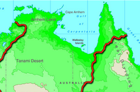
The coast of the Gulf of Carpentaria includes some of Australia’s wildest and most remote country. Before early explorers returned from the area with tales of unparalleled hardships, a plan existed for the coast to harbour a busy port, trading with the wealth of Asia. However, the terrain made any such plan an impossibility.
The Gulf coast is interlaced with hundreds of drainage channels carrying wet season rains away from the flat country farther inland. The flatness of this inland terrain causes the water to sweep across the plains in sheets, or thousands of tiny rivulets, rather than being directed into one or two major rivers. In mountainous country, rivers run only into each other. Here, the land is so flat that water can and does flow out into two or more forks from the one source. This constant fanning out of watercourses, combined with a sheltered coastline and a tropical climate, results in a twisting, jungle lined delta – utterly inaccessible by an overland route to this day.
Burke and Wills discovered at first hand just how challenging (and at times just downright impassable!) the gulf country could be, most notably in the wet season. They were even prevented from completing the last 6 kms to the ocean because of their path being blocked by mangroves. Imagine how frustrating this must have been having just walked 1100 kms! They took the tidal flow in a nearby river as proof of completing their mission – to reach the sea – before turning around and heading back again..
The following is an excerpt from Alan Moorehead’s ‘Coopers Creek’.
“They had struck the wet season; day after day the warm rain poured down, and the camels hated it. They foundered around in the boggy ground, moaning and groaning, and Billy the horse grew very weak. Something like 170 miles still divided them from the sea, and they followed the Cloncurry River downstream to the point where it joined the Flinders River….by the end of January they had reached the Flinders River, and were moving slowly down the Byrno, which was one of its outlets to the sea. The mud was frightful.”
Suggested learning activities:
- research other examples of flood plains either in Australia or another country. Make a comparison between how rivers behave in a flood plain versus a mountainous terrain. Draw pictures where appropriate.