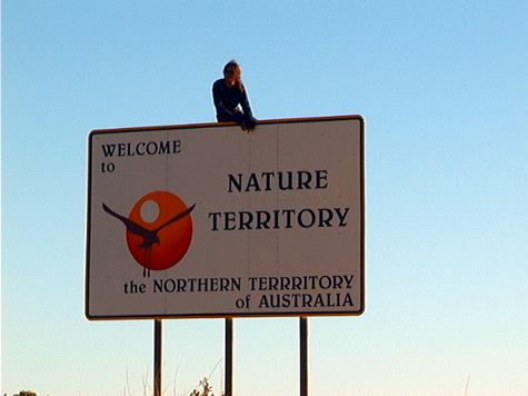
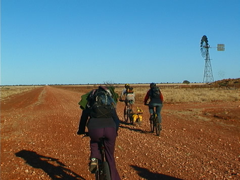
The sign said ‘Welcome to the Northern Territory of Australia: Nature Territory’ as Mike and I passed, leaving behind Queensland and crossing into the Northern Territory. A contrast between what we’ve left behind and what we have to look forward to seems in order.

The area of Queensland at 1,727,200 square kilometers, makes up 22% of the Australian continent. Green, productive lush rain forests, fields of sugar cane, and national parks on the east between the Great Dividing Range and the Coral Sea, give the tourist industry an outlet to the Great Barrier Reef. To the west of the Great Dividing Range, vast areas of agricultural land rich in volcanic soils comprise the tablelands.
Perhaps the region that we’ve spent the most time cycling through is the vast outback that lies inland. It fades into the Northern Territory to the west. Rain can make this arid region bloom, but it’s a land of sparse population, long empty roads and tiny distant settlements.
We’ve seen examples of the collection and storage of water from the Great Artesian Basin, created over a period of 2.5 million years as water gradually seeps westward from the Great Dividing Range. It fills approximately 7500 artesian wells that provide the only source of continual water for huge cattle stations. The Wet season does provide a variation on this theme as countless dry river beds become swollen creating a network of waterways which can make travel impossible.

By contrast, the Northern Territory makes up 17% of the Australian landmass, an area of 1.35 million square miles. Although about 80% of the Territory is in the tropics, as the Tropic of Capricorn bisects the continent north of Alice Springs, only the northern 25%, known as the Top End, resembles a tropical climate. There, savannah woodlands and occasional rainforests are in direct contrast to the desert, semi-arid plain in the southern three-quarters to the south.
Today we have slipped through the door to the Northern Territory. Alice Springs, to the southwest, awaits us as we journey toward the Red Centre.
Suggested activities: Compare regions where you live, i.e., climate, temperature averages, rainfall, topography. Investigate the reasons why these regions vary in contrast to each other. Identify mountain ranges and plateaus, which influence rainfall amounts. Discuss how is agriculture affected by climate and what types of crops/livestock are grown near you.