« August 2001 | Main | October 2001 »

September 2001 Archives

September 3, 2001

Geology & Heat Conduction

2001 September 3, Monday. Bluff Camp Ground.

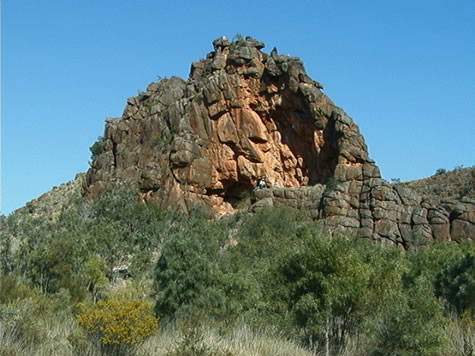
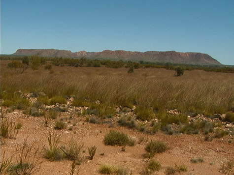
As we rode between Ross River Homestead and Trephina Gorge Nature Park yesterday evening, the moonlight showed clearly the silhouettes of craggy rock peaks, though the road snaked gently through the broad valley bottoms. We became aware of significant changes in air temperature as we turned corners and passed by different vegetation, and traced this variation to a number of sources:

Throughout the day, warmth from the sun is absorbed by the earth. Rocks, sand, and hillsides, all are hot to the touch by mid afternoon in the powerful desert sun. As night falls, the sun no longer warms the air, and gradually the entire landscape freshens.

red_rock_outcrop.jpg

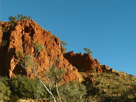
First the eastern aspects of the hills, which have already been in shadow for some hours, begin to chill. Creek beds follow closely after, because of the moisture from underground sources, and the protection offered by the vegetation including river red gum trees. West facing slopes and dry exposed earth reach a higher temperature throughout the day, and take longer to cool after sunset.

The various times taken for these features to release their solar heat create these pockets of different temperature air, and the still of these winter evenings combined with the protection offered by the mountains prevents the temperatures between them from equalising quickly.

Because of this system, the earth has lost all of its stored heat by dawn, and the burning heat of each day begins with a cool morning – sometimes approaching freezing point. This is the time we do our most efficient biking, and the main reason we tried a night ride.

Go for a walk out of doors and feel the temperature of different objects, both in and out of direct sunlight. Try grassy and open ground, a tree trunk, a concrete surface and a piece of metal. Which objects conduct more heat? Write down your observations.

bel

September 4, 2001

Landforms - Corroboree Rock

Just off the Ross Highway, some kilometres northeast of the Emily and Jessie Gaps, is a weathered, rippled rock called Corroboree. It began to be formed some 800 million years ago when a shallow, salty sea laid down a fine silt. Algae grew over this silt and shaped itself into mounds that solidified into rock over millions of years.

corroboree_rock_back2.jpg

The movement of the earth caused the folding of strata (layers) of rock into the vertical plane, causing the original horizontal layers to stick straight up out of the earth in the form of a ridge. Wind, rain and sun gradually wore down the ridge, with only Corroboree, a particularly hard section of rock, remaining today.

The three predominant colours in the rock are black, orange, and white. The black colour comes from the oxidation of iron particles within the stone, and the orange and yellow are the result of tropical weather conditions.

Suggested learning activities: Identify an example of weathering of a geological feature in your local area. Compare and contrast the weathering forces (sun/rain/wind etc) to those operating on Corroboree.

Git

September 16, 2001

The Geography of Gosse's Bluff

Geography – day 55

While biking on the road from Hermannsburg we explored an incredible feature in the landscape: Gosse Bluff; a 5km wide crater thought to have been formed by the impact of comet slamming into the earth’s surface around 140 million years ago.

gosse_bluff_crater.jpg

The shallow depth of the blast lends weight to the theory of either a comet, or a low-density asteroid and not a solid rock meteorite. However, no trace of a comet or asteroid was been found in the area, and it is presumed to have vapourised.

The blast has been calculated to have been about one million times more powerful than the Hiroshima bomb. It would have destroyed most life forms within a distance of hundreds of kilometres and sent huge plumes of fine debris into the atmosphere, affecting weather patterns worldwide for some years. This would certainly have made for a very challenging environment for plant and animals species seeking to recolonise the surrounding area after the event.

During the blast, fragments of rock, included blocks up to a hundred metres long, were hurled into the air and then fell back to the ground.

The comet would have consisted of a frozen ball of carbon dioxide, ice and dust. Late Proterozoic-Cambrian Rock, 500-800 years old and comprising sandstone, siltstone, shale and limestone, would have been blasted to the surface from more than 6km down. Using satellite imagery we can estimate the original outer crater being up to 20km in diameter. A long period of erosion and wet climate has have since removed this almost entirely, leaving the inner crater of 5km that we see today (see photo).

There is a close parallel with craters that can be found on the surface of the moon and Mars. Similarities are the breaking up and bending of rock layers with in a roughly circular area, a crater, uplifted rock in the centre, shatter cones, melted rock fragments, and minerals that are formed only at extreme pressures.

Suggested learning activities: look at how volcanoes are formed and explore the differences and/or similarities to the impact of extra-terrestrial bodies into the earth’s surface (like at Gosse Bluff).

September 24, 2001

Extreme Climates - The Tanami Desert

Geography – Tanami desert

The beginning of the Tertiary period in the earth’s history was typified in central Australia by high temperature, rainfall and silcrete formation in extensive low-lying inland areas such as the Tanami Desert. This resulted in the deposition of the poor, sandy soils that we’ve been biking through the past 3-4 days since arriving at the Tanami track.

tanami1.jpg

So why is the Tanami Desert flat but not so the Macdonell Ranges to the South and The Kimberly to the Northwest? One theory is that the Tanami forms a pivot around which a gigantic block of the earth’s crust rotated forming mountains (Macdonell Ranges) and a trough (The Kimberly). The central Tanami area – being the pivot – has therefore avoided any influence from uplifting or tearing of the earth’s crust.

This flat terrain promotes a semi-arid climate, as any moisture from rainfall perculates quickly through the upper strata of sandy soil. Also, any influence from the ocean in the form of moist air, for example, is minimal. However, fluctuations in global weather patterns can affect the geography and ecology of the region quite considerably, making it possible for a non-indigenous species – like the rabbit – to thrive so well as it has in the past (hence the name Rabbit Flat where we spent most of today laying up from the midday heat). For example, for the past 3 x years Australia has been experiencing unsually wet conditions, with higher than average rainfall. This has led to there being far more vegetation that we expected. Instead of miles and miles of bare sand dunes we’ve been treated to quite a varied desert-scape rich in spinifex, desert oaks, acacias and mulga trees.

Suggested learning activities: examine a region in your country that is subject to quite extreme climatic conditions. Investigate how fluctuations in weather conditions have affected the region’s geography and/or ecology.

September 27, 2001

Geography and Land Ownership Rights

Aboriginal Rights and GEOGRAPHY

Land Rights:

Since Alice Springs we’ve been biking through predominantly aboriginal freehold land. This means the land was given back to the traditional aboriginal owners sometime since The Aboriginal Land Rights (NT) Act of 1976, which for the first time in Australia’s history recognised the relationship between aborigines and the land. The brown areas you see on the map, for example, represent such ownership of land – which lasts ‘forever’ and includes all mineral and oil rights under the first 150mm of soil. The white area marks a pastoral lease from the government to the Supplejack Downs cattle station – which means the station owners do not strictly ‘own’ the land, only lease it from the government on a 99 years renewable basis. The other catch is they have no rights to anything of value under the first 150mm of soil.

derwent_station_bel.jpg

So, how does geography play a part in all this? The brown and white areas we see on a map of the North Territory tells us a lot about the surface ‘value’ of the land in terms of water and the capacity to support livestock (predominantly cattle in this case), and the hidden ‘value’ of the land in the form of mineral and oil deposits. They also give us some clues as to the whereabouts of landforms and geographical features in the landscape that are considered sacred by local aboriginal ‘guardians’. The reasons for both are as follows:

When the Aboriginal Land Rights (NT) Act was passed in 1976, the only land allowed to be claimed was land outside town boundaries and that not already owned or leased by anybody else. This, for the most part, meant either semi-desert or desert as any ‘valuable’ land with water on it (in the form of springs or bores) or vegetation that could support cattle on it, would already be spoken for. So, you could say that only land that was useless to the settlers would be given back, as a form of tokenism to defuse the rising pressure the government was facing from aboriginal groups seeking Land Reform from WW2 on. The brown areas therefore largely represent desert regions of little economic use, whereas the white areas represent pastoral leases on land that has water or is in some other way of economic value to the people farming it.

tanami_desert_map.jpg

Sacred sites are also key to the whole Land Rights Issue, as one of the conditions for land to be given back to its traditional aboriginal owners under the Aboriginal Land Rights (NT) Act is that a claimant has to prove under aboriginal law that they are responsible for the sacred sites on the land being claimed. Such sacred sites represent evidence of a dreamtime ancestor having passed that way and left some mark: a pile of stones or even a tree. Some sites are very obvious – like Uluru (Ayers Rock). Others are less so and might not even be visible to the human eye. So the geography of the landscape is very often instrumental for determining whether a piece of land is returned to its traditional aboriginal owner or not.

We can conclude therefore that by looking at a Land Ownership map of North Territory we can make some rough guesses as why certain areas are coloured the way they are and what assets – either economic or religious – the land holds.

Suggested Learning activities: research an example of land ownership conflict in your local area and make some calculated guesses as to what ‘value’ the land represents to the interested parties and for what reasons they might therefore be in conflict with each other.

About September 2001

This page contains all entries posted to Australia Lesson Activities - Geography in September 2001. They are listed from oldest to newest.

August 2001 is the previous archive.

October 2001 is the next archive.

Many more can be found on the main index page or by looking through the archives.

Powered by
Movable Type 3.35