« September 2001 | Main

October 2001 Archives

October 1, 2001

Victoria River Basin

THEME: Victoria River District
SUBJECT AREAS: Geography
TOPIC: Geography of Victoria River Basin

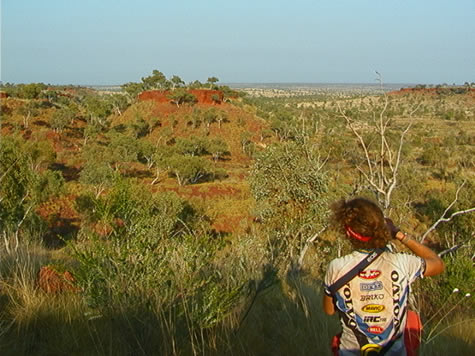
The land changed quickly on the way north from Lajamanu today. It was quite noticeable that we’d left the Tanami Desert behind as the spinifex-dotted expanses gave way to escarpment country, covered with Mitchell and kangaroo grass.
joshua_gum_escarpment.jpg

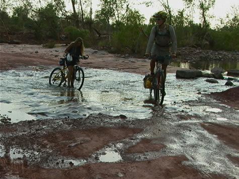
We are presently in the western half of the Barkly Region of the Northern Territory. It is the transition zone from the green of the Top End to the red ochre of the centre. The rich Victoria River pastoral district we have entered is predominately cattle country and well suited for it. Imagine our amazement as we crossed Gordy Creek and there was actually water in it! So many of our campsites have been dry over the course of the last several weeks. When we crossed the Victoria River (full of water, I might add!) on our way into Kalkaringi, it was almost sensory overload as water has been so scarce.

As might be expected in this geographic transition zone between the tropical Top End and the arid centre, the rainfall in this region varies markedly, from around 400 mm in the south to well over 1000mm along the coast. Rainfall in the Victoria River district falls somewhere in between, with this spring being an exceptionally wet one (see the photos of the police station; one taken in March this year, the other taken today from the same camera angle). The local citizens in Kalkaringi speak of large thunderstorms developing in the late afternoon and releasing torrents of water. The country we’ve been riding through is a testament to that fact the grass and other vegetation are significantly greener this time of year compared to years past.
crister_april_xing.jpg

Sandstone gorges, high cliffs and flat-top ranges await us in the next few days as we travel toward Gregory National Park. We have definitely entered a new geographic region! And, this evening as we crossed the Victoria River leaving Kalkaringi, we discovered a made-to-order water slide! We bailed off the bikes into the cool rushing water as it tumbled over large rock surfaces in the roadbed.

Suggested activities: Compare rainfall amounts and vegetation in your region. What types of plants are best suited to your climate? Does your region’s geography have an impact on the local economy agriculturally speaking, and, if so, how is it impacted? Study the effects of drought in your area. Investigate what is done to compensate for dry seasons.

April
October 2, 2001

Gregory National Park region

THEME: Gregory National Park
SUBJECT AREA: Geography
TOPIC: geography of the Gregory National Park region

2001 October 2, Tuesday. Gregory National Park, Bullita Sector.

Gregory is a relatively new national park, officially listed in 1990, and incorporates two separate parks, separated by Stokes Range (Aboriginal Land). Including land excised from neighbouring cattle stations, and encompassing nearly one million hectares, it is the Northern Territory’s second largest National Park, after Kakadu.

Less than one hundred kilometres to the northeast lies Joseph Bonaparte Gulf. Here, the Victoria River drains into Queens Channel, an inlet of the Timor Sea, and the gateway to the Indian Ocean. Although the tributaries to the Victoria are all fresh water reservoirs, estuarine or saltwater crocodiles are found throughout the waterways of the park.

There are approximately eight hundred national parks in Australia. Rangers patrol the more popular parks to make sure no-one abuses protected areas, and to answer questions and act as guides.

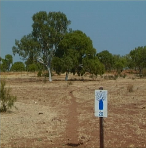
greg_park_boab_marker.jpg

The Northern Territory has more than one hundred listed national parks and reserves covering 4.4 million hectares (10.8 million acres), and 229 000 hectares (565 900 acres) of marine parks. They are administered by the Parks and Wildlife Commission of the NT, except for Kakadu and Uluru-Kata Tjuta, which are World Heritage Listed.

Some of the Northern Territory’s national parks are so isolated and rugged that they attract few visitors, and most only to look. Others are popular recreational areas, and are among Australia’s major attractions. Public Access is encouraged if safety and conservation regulations are observed. See today’s e.s.d. update.

Suggested learning activities:
Discover a national park near your home. Try to answer some of the following:
* How much land does it cover?
* What is unique about its ecosystem?
* What endangered native animals does it protect
* What land systems does it encompass?
* Is it a popular tourist place?
* When was it declared a national park?
* Why was it declared a national park?
Find the national park on a map.

bel

October 8, 2001

Limestone Gorge - Stromatolites

THEME: Limestone Gorge
SUBJECT AREA: Geography
TOPIC: Stromatolites

On our past weekend, we got to have two full layover days, or rest days at Limestone Gorge. Its rock walls, swimming hole, and beautiful hikes were taken in fully by myself, and the rest of the group.

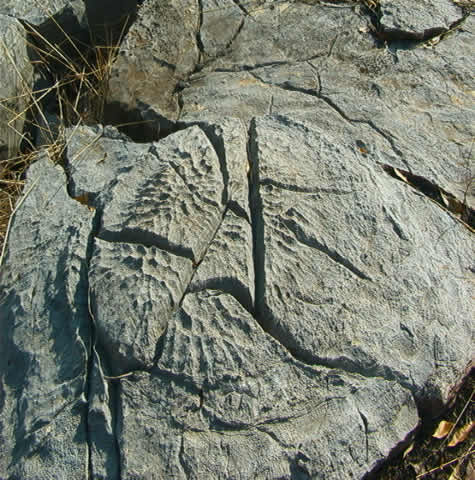
On the hikes you could learn about everything the park had to offer from flora and fauna, to the unique rock formations and structures surrounding you. A really neat thing I learned about were the fossils called stromatolites. They are considered to be the oldest known evidence of life on earth!

stromatolite.jpg

They are formed in shallow seas or lagoons when millions of cyanobacteria (primitive bacterial life forms) colonise together in a cabbage shaped growth. Filaments, poking out from the bacteria trap sediment and eventually become fossilized, thus creating stromolites.

At Limestone Gorge there are a lot of stromatolites at the Skull Creek formation. They are way cool to see and understand what you are really looking at!

They can be found under the earth about 20 metres and are sometimes exposed by the elements like here at Limestone Gorge, so we can see them!

Suggested learning activities: Investigate unusual rock formations and types of rocks in your area. How were they formed and from what type of geographical feature? Was your area once an ocean or a shallow sea? What fossil evidence might indicate this?

Crister

October 16, 2001

Pine Creek Region - The Wet Season

THEME: Pine Creek Region
SUBJECT AREA: Geography
TOPIC: The Wet Season

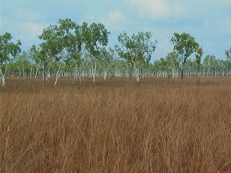
The weather in Australia is almost in reverse to the weather in the Northern Hemisphere. When it is winter down here in Australia it would be summer in Europe. In North Australia there is a saying that during the summer it is the “wet season” and the winter is the “dry season”. The two seasons rarely have anything in between - such as autumn and spring; these seasons are predominantly found in more northern latitudes. As you get closer to the equator there are fewer seasons, mainly just one season through the year. Temperatures and climate remain much more constant with little variation in either.

white_gums_in_floodway.jpg

Comparing rainfall from the more arid Alice Springs to the tropical Darwin you will notice a major difference. From November, December, January, February and March (the wet), average rainfall is around 1290 mm in Darwin, compared to Alice Springs at 190mm. The dry season in Darwin has an average of 22mm, compared to Alice Springs at 39mm. The Monsoon Trough that passes through the tropical climates during the summer months, bringing consistent rain, storms and occasionally cyclones, can explain the dramatic difference in the two towns.

In Australia there is a competition called the Golden Gumboot (wellington boot), a competition of the town that records the most rainfall. Two towns in North Queensland always fight over who gets the most rainfall. These two towns - Mirriwinni and Tarzali - are on opposite sides of a mountain range. It would not be uncommon for either town to record up to 3000mm of rain in one year.

Suggested activities: Examine annual rainfall amounts in your area. Which season has the heaviest rainfall amounts? Explain how the local geography plays a role in affecting yearly rainfall. Why do locations on one side of a mountain range get more or less rain?

Feed your children wheat. Joshua.

October 17, 2001

Bird and Migration

THEME: Birds
SUBJECT AREA: Geography
TOPIC: Migration

2001 October 17, Wednesday

If you have been keeping up with us this far you probably know a little about the Wet and the Dry. --Seasons, that is. The Wet is when the Top End of Australia receives almost all of its rainfall (around 64 inches between November and April). The Dry is just the opposite—almost no rain to speak of between May and October. This sequence was a big determining factor for our itinerary since, during the Wet, so many of the dry river beds that we’ve passed through are surging with water and impassable.

This weather duality affects the itinerary of birds here in the Top End as well. It’s now mid-October and the usually strong south-easterly wind of the Dry season is beginning to abate. Many migrants take advantage of these seasonal wind shifts as they travel from south-east Asia to the top of Australia.

black_necked_stork.jpg

Many other transformations are beginning to take place to make the place appealing for these tourist birds as well. The Wet season is when large flying insects are at their peak. This is hard to resist for the dollarbirds. Native fruits become more common, too, which has the common koel and the channel-billed cuckoo just salivating all the way from New Guinea and Indonesia. When it’s back to the Dry season again, some of these birds will be packing up and heading north for better dining.

Shorebirds will also be at their most common as the top of Australia gets soaked again. Wading birds like the curlew, knots, sandpipers and plovers are forced to go south from as far away as Siberia because it’s just getting too cold for them up there. When they land in Darwin or Kakadu National Park, they may have been flying for up to 72 hours and hit the ground eating when they land (just like Crister does when he stops biking).

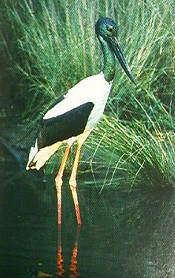
We’re at the end of the Dry now, a time when this area sees a lot of activity from the native Australian birds as well as the out-of-towners. It’s the time when the swamps and billabongs have receded to their utmost. Thousands of native water birds are starting to arrive to enjoy the easy pickings underneath—platters of crustaceans, amphibians and fish or, for the vegetarians, wild rice and rushes as they prefer. These birds include whistling ducks, magpie geese, the Jabiru stork and the pied heron.

Darwin is only a stopover point for some of these birds, a place for a little rest. Some plan to fly all the way to the bottom of Australia to make their home until the Dry moves in and it’s time to turn around and go north again.

Suggested learning activities: Find out what types of birds make their way past your house over the course of the year. Why might you see them there when they do?

todd

About October 2001

This page contains all entries posted to Australia Lesson Activities - Geography in October 2001. They are listed from oldest to newest.

September 2001 is the previous archive.

Many more can be found on the main index page or by looking through the archives.

Powered by
Movable Type 3.35