« Overland Australia - Update 41 | Main | Overland Australia - Update 43 »
September 14, 2001
Overland Australia - Update 42
September 14, 2001
Day 53
Namatjira Drive, West MacDonnel Ranges: Alice Springs, Gosse Bluff, Pupunya Turnoff.
As the eight bicycles wound up a hillock crest which had been signposted as Tyler’s Pass lookout, a radio-communications tower came into view, and I immediately asked: “For how long are we going to stay here?” The answer came, offhandedly: “About half an hour.” I needed no further encouragement. Riding up alongside the high barbed fence, I launched myself over – undeterred by the black and orange sign warning of broadcast frequency radiation within the enclosed area. I approached the base of the mast-like antenna pole, and took a deep breath as I thought of the similar tower we had encountered earlier in the trip, at the abandoned Starke homestead.

There, the tower’s lowest section had been smooth and featureless for around five times my own height - to deter people from climbing it for their own safety. The ascent had taken some work, but the view had been well worth the effort. Here, the set up was the same, but with an interjecting pipeline, and in a couple of minutes I was gently moving with the breeze which swayed the top of the tower, admiring the 360 degree view, and the circular tessellations of desert vegetation below me.
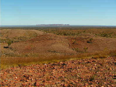
The jutting blue summits of distant ranges could be seen to the East, while hidden from viewers at ground level by a broad, scallop-patterned mesa like those we had seen in the East MacDonnel Ranges. Turning to the North, the hillocky country we had just entered appeared as evenly undulating spinifex-covered mounds; and the route we were to travel out along was a smooth red line, which snaked away to a vanishing point. Further around, a vast flat desert-scape was broken by a mammoth circle of abrupt peaks - the five-kilometre broad Gosse Bluff meteorite crater.

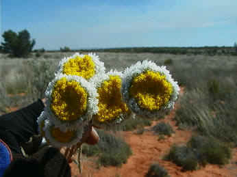
Formed 140 million years ago, when a kilometre-wide comet struck the earth, destroying all life within a hundred miles; the incredible landform appears quite at home in the surrounding dramatic countryside. Due South, veiled by the drifting smoke of wildfires, lay the road we had crawled along through the morning, constantly stopping to appreciate and film the many attractions of the desert landscape in a time of recent rain. The intoxicating scent of wildflowers accompanied their colourful display: orange, blue, several shades of magenta and pinks, yellows, and delicate white were all represented, our favourites being the Poached Egg Daises and the Silvertails.
We had reached Hermannsburg mission settlement late-morning Wednesday, and spent the day filming and looking around. We then used the early evening to escape the sealed road before setting up a terrific camp in clean bright red sand, surrounded by porcupine spinifex - a punctured truck tyre was a small price to pay for a camp away from the tourist road. This left us with a whole day of wonderfully sandtrappy, rocky, clay track ahead, apart from an incongruous though short stretch of wide, new road seemingly joining nowhere to nowhere. Taking in some native grass trees (and a posing kingfisher), a feral camel, (who challenged Mike to a race, then cheated by cutting suddenly in front of him) breathtaking views, the regular billy-tea break, and several GPS check stops; we covered less than our usual amount of clicks, but took the time to admire them all thoroughly. This afternoon we set up camp number fifty-three, among Blue Mallee and flowering shrubs full of singing honeyeaters. A clear ochre sunset softly silhouetted the eucalypts and left the starshine to see us through until another crescent moonrise just minutes before dawn.
Bel
Posted on September 14, 2001 1:17 PM