Here
is some of the equipment we use to navigate our way across the world's
oceans:
 |
>>
GLOBAL POSITIONING SYSTEM
We
use a Magellan Nav 6000 GPS (Global Positioning System) to
give a latitude and longitude position - or ‘fix’
- at least once a day.
|
 |
>>
PAPER CHARTS
Every
24 hours we mark the latest GPS coordinates (latitude and
longitude) on a traditional marine chart to find out our exact
location on the ocean. Once out of sight of land, the chart
is the only point of reference point to knowing where on earth
we are!
This
'position' can then be used to determine the distance and
direction we've traveled since the last fix, and what compass
heading we want to make in the next 24 hours.
|
 |
>>
ELECTRONIC CHARTS
The
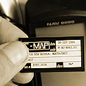
Nav 6000 also takes special C-Map cards that store traditional
chart information on small chips. As well as saving space,
they also enable the GPS component of the unit to marry directly
with the charts.
However,
due to the likelihood of any electonics failing at sea, they
are a compliment, not an alternative, to traditional paper
charts.
|
 |
>>
MARINE COMPASS
From
the paper chart we work out a compass 'heading', which is
the direction we aim for throughout a 24 hour period until
the next GPS fix is taken.
210
degrees for example is an approximate heading of SSW (south
south west), with 180 degrees being due south.
|
 |
>>
SEXTANT
If
the electronics fail we have a sextant as back up. This device
was used in the old days before satellites and GPS’s
were invented. You can use it to measure the angle of the
sun or any other celestial body to the horizon. By referring
the date and time of the reading to an almanac it is then
possible to calculate your latitude/longitude position. Although
a lot more complex than just switching on a GPS, it is still
an essential piece of kit to have on board, especially given
the frequency with which electronics tend to fail when subjected
to a salt-water environment for any length of time.
|
>>
back to EQUIPMENT
|
